The Oderwald is a salt structure, like the Elm, the Asse or the Harly. Due to its lower density compared to limestone, sandstone and mudstone, rock salt has moved upwards, causing the overlying layers to bulge. As a result, sedimentary rocks from greater depths are exposed on the earth's surface. In the Oderwald, which is only shallowly arched, the rocks of the Cretaceous period have thus reached the surface.
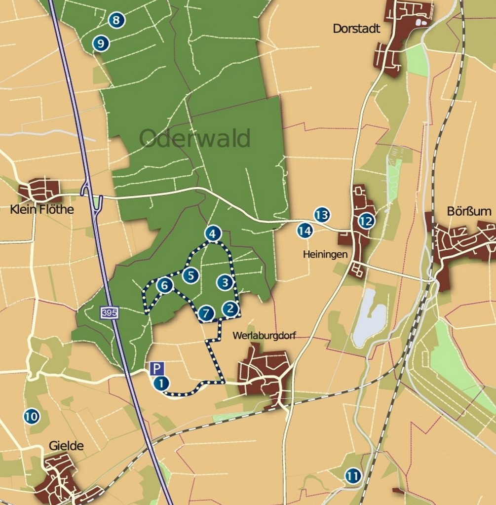
Directions: From Braunschweig heading south on the A 395 motorway to the Oderwald car park exit. Head east on the L 512 and follow the signs.
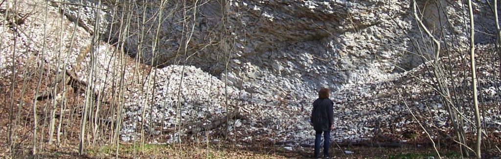
The signposted Geopark circular trail leads along the Flammenmergel at point 2, over the Hilssandstein (point 3), which used to be quarried for building purposes, to the minimus clay (4), which was the raw material for a brickworks, back through a valley that is full of wildflowers in spring (5), to a former quarry in the white chalk limestone (6) and finally to a vantage point with a panoramic view (7). There are other points of interest in the vicinity of the geological trail, which are also marked with dots on the map: