Lichtenberg (Schloss Salder)

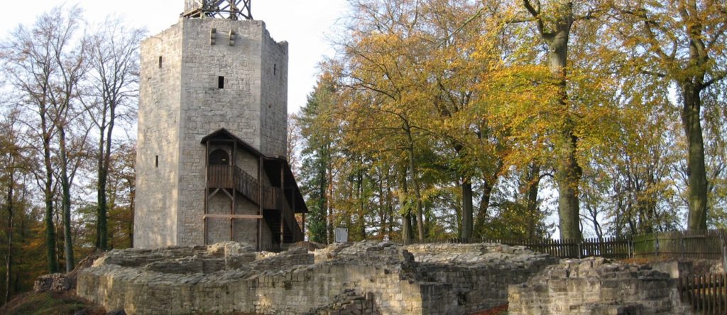
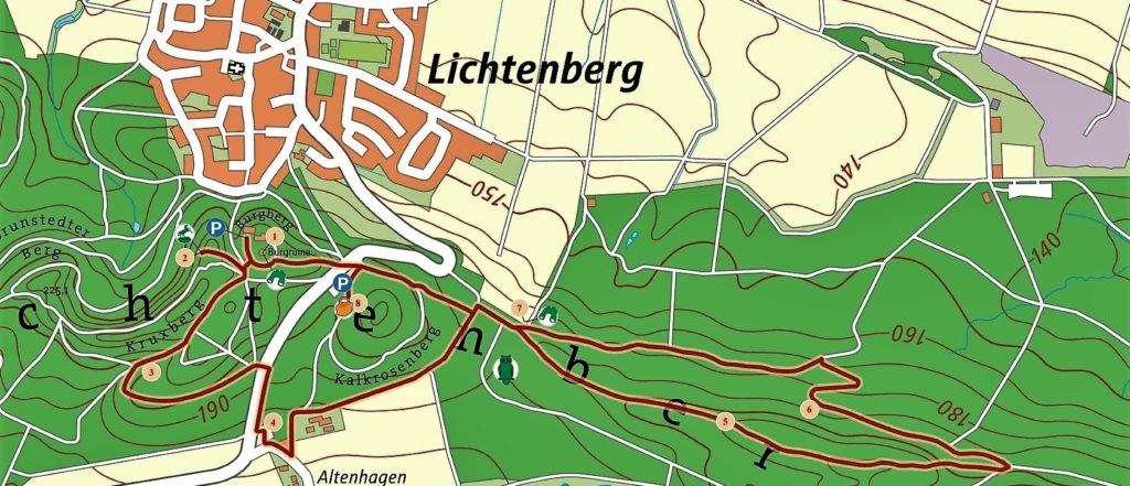
The ruins of the castle are the starting point of the geopath, which leads as a circular hiking trail 8 km through the beech forest of the Salzgitterscher Höhenzug landscape conservation area. On the way, the deposits of the mussel limestone period in particular come to light. After more than 200 million years, the rocks still contain traces of the life forms of the sea at that time.
Remains of crinoides, brachiopods, ammonites and mussels are most common. The calcareous soil offers beech trees, but also precious foliage such as ash and mountain maple optimal growing conditions. The herb layer is rich in early bloomers. In addition to black woodpecker, hollow pigeon, forest-leaf-warbler and a variety of other smaller forest-dwellers, wildcats, badger, fox, deer and wild boar are also native to these forests.
If you follow the signpost Geopfad Lichtenberg, the first thing to do is to reach the quarry at Kruxberg, where the deposits of the Upper Muschelkalkzeit, which are up to 10 m in power, are open. The mining of the Trochiten kalkas, which began in the Middle Ages as a building material, has left a 900 m long and up to 70 m wide quarry on the Hardeweg Forest.
The forest path ends at the highway. On the other side of the road, the trail leads up hill again to the starting point. If you drive back over the K 40, through Salder, you reach the district of Gebhardshagen and after about 600 m the castle.
Suitable for strollers. Length approx. 4 – 5 km, duration 1 to 2 hours
How to get there: From Braunschweig to the south-west on the A 39 to the exit Salzgitter-Lichtenberg, turn left onto Burgbergstraße to Lichtenberg. Follow the signs.
Unfortunately, the castle tower is currently not accessible due to a fire!

© 2020 Geopark Harz . Braunschweiger Land . Ostfalen
