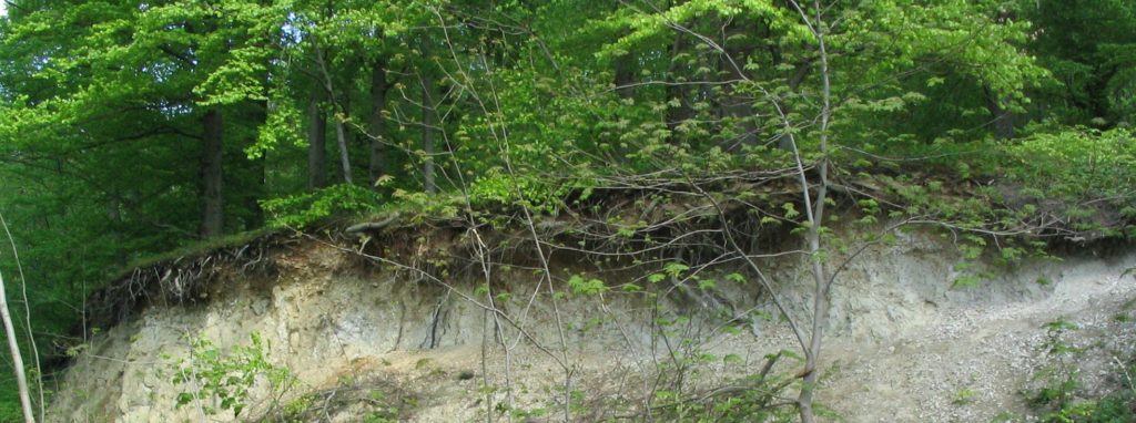
Located on the northern edge of the Classical Square Mile of Geology, this ridge is at least as remarkable as the Salzgitter ridge. The salt-tectonic narrow saddle of the Harly runs parallel to the resin. In the western part, due to the rise of the salt and the associated lifting, a sequence from the Lower Buntsandstein to the Upper Muschelkalk is open.
Until the 1930s, the Harly Rogenstein was mined as a workstone. This special sandstone is recognizable by its peculiar structure: small balls are reminiscent of fish spawn (Rogen). The varied flora and fauna is a reflection of the geological diversity in a confined space. Consequently, the Harly is designated as a protected landscape area. For those seeking relaxation, it is accessible by three adventure trails (start and finish each of the Klosterkrug at wöltingerode Abbey).
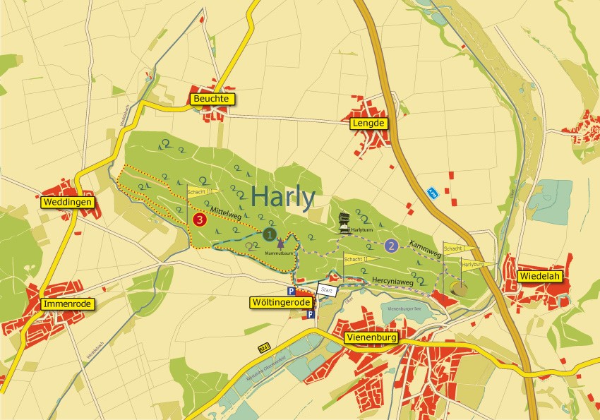
Path 1: Middle Harly. Southern edge of the forest, geological outcrops, bear valley with the “herbal August cave”, sequoia tree, disused shafts. (2 hrs.
Path 2: Eastern Harly. Bärental, Harlyturm with a view over the Okeraue, high-altitude trail through beech forest societies, former Gypsum and limestone mining, Rogenstein, remnants of the Harlyburg, shaft. (3 hrs)
Path 3: Western Harly. Mammoth tree, Waldmänneckenhöhle, either along the Weddebach or a Rogenstein digestion past the third shaft. (3 hrs)
Northwest of Vienenburg, suitable for strollers. Duration 2 to 3 hours each
How to get there: From Braunschweig from the south via the A 395 to the exit Vienenburg, west on the B 241 to Vienenburg, follow the signs.