
Minister Tonne was briefed on the geopark.
Recognised by UNESCO: The Peine region is geologically very special
By Kerstin Wosnitza
Lengede, 21 January 2026
Seas came and went, mountains rose, salt pushed up from the depths to the surface:
What appears today as a varied cultural landscape is the result of immense geological processes. The Braunschweiger Land Geopark, which includes parts of the Peine district, combines these testimonies of earth's history with archaeological finds, historical sites, and modern environmental education. The region is one of Germany's most significant geolands. This has been recognised by UNESCO.
As of 1 January 2023, the municipality of Lengede has been a member of the UNESCO Global Geopark Harz, Braunschweiger Land, Ostfalen. This covers a total of almost 10,000 square kilometres between the Harz Mountains and the Heide, and is divided into two sub-areas.
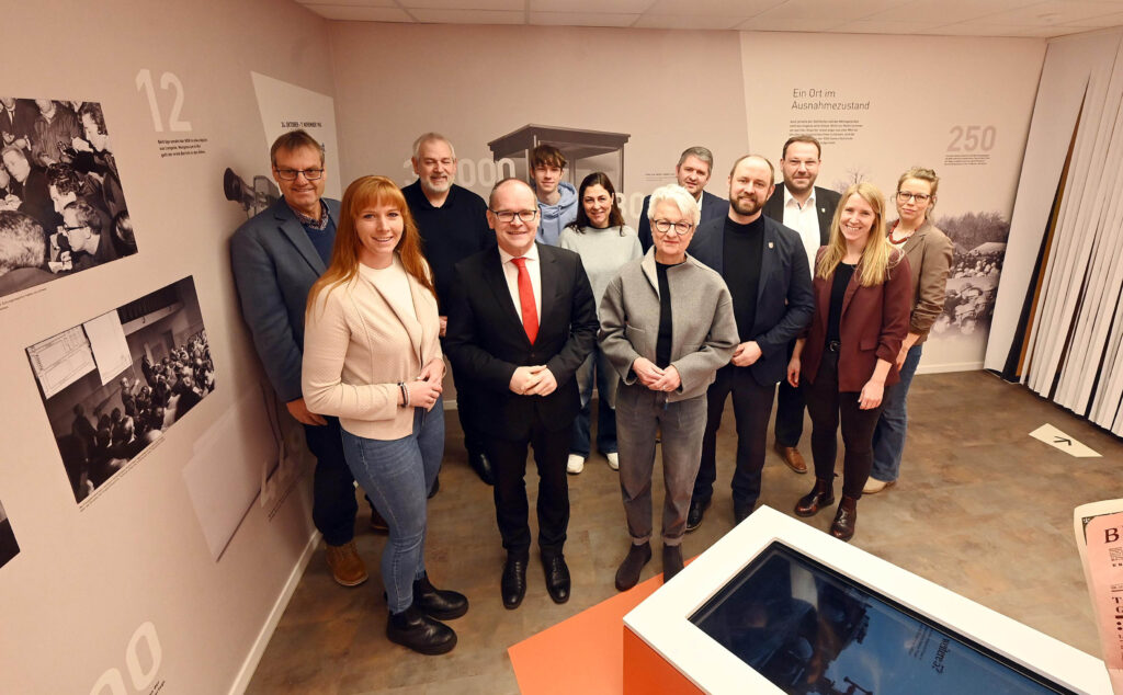
Lengede, represented by Mayor Maren Kleinschmidt (SPD), recently hosted a meeting of the northern Braunschweig Land regional association, which took place at the „Miracle of Lengede“ museum.
In addition to representatives from other member municipalities such as Schöningen, Cremlingen, Wolfsburg, Grasleben and the district of Peine, as well as employees from the Geopark office in Königslutter, the Lower Saxony Minister for Economic Affairs, Grant Hendrik Tonne (SPD), also attended.
The minister was informed about the tasks and importance of the geopark, as well as the concerns and worries of those involved. This included discussions about finances. „While each local authority pays a certain contribution, overall we receive around €250,000 per year from this fund,“ explained the chairwoman of the supporting association, Wolfenbüttel district administrator Christiana Steinbrügge (SPD).
Eighty percent of this money would be used for fixed costs – not leaving much room for projects. Therefore, funding is of great importance. Minister Tonne showed understanding and made it clear that the timing to get involved politically is currently favourable:
„The debate for the 2027/2028 budget year now begins.“
He also pointed out new guidelines for tourism promotion, from which the geopark could benefit. At the same time, however, he dampened hopes of extensive financial support, as the state government's scope for manoeuvre was limited.
Background information on the Geopark was provided by the head of the administration in Königslutter am Elm, Dr. Henning Zellmer. He answered the following questions, among others:
What exactly is a Geopark?
In 2015, UNESCO created another category alongside World Heritage Sites and Biosphere Reserves: UNESCO Global Geoparks. The prerequisite for this designation is an area of outstanding geological significance with a regional and international impact. It must also contain archaeological, historical and cultural features that are closely linked to the natural resources.
The focus is on people in their interaction with the landscape and natural resources. The requirements for Geoparks are high: the title is awarded for four years at a time and must subsequently be reconfirmed through a new, extensive application process.
Geoparks fulfil several important tasks. They protect and manage geological heritage, which includes rocks, fossils, and landforms of outstanding scientific and scenic value. They also promote sustainable tourism, encouraging visitors to explore and appreciate the unique geology of the area while supporting local economies. Furthermore, Geoparks serve as educational hubs, raising public awareness about Earth sciences, the history of our planet, and the importance of geological conservation. They also facilitate research and provide opportunities for scientific study and discovery within their designated areas.
A geopark serves sustainable regional development. The task is to network existing facilities and to initiate and implement joint activities in geotop conservation, leisure and tourism, as well as environmental education and scientific research.
How many geoparks are there?
There are 229 Geoparks in 50 countries worldwide.
109 of these are in Europe, eight in Germany, and of those, two are in Lower Saxony. The Harz, Braunschweiger Land, Ostfalen UNESCO Global Geopark is the largest geopark in Germany and the second largest worldwide, covering almost 10,000 square kilometres. Around 1.2 million people live in its area.
What is the significance of the Braunschweiger Land Geopark?
The history of humans has always been closely linked to landscape and resources. For our region, this means: the first agricultural cultures settled because of the loess soils in our region, the Romanesque buildings would not have reached their splendour without the shell limestone and sandstone, and without copper, lead, zinc and silver in the Harz mountains. Without the iron ore in Salzgitter and Peine, no steel industry would have developed there, and subsequently neither would Volkswagen. The connections extend to the present day: without the decommissioned mines, there would not be the at times highly problematic nuclear waste storage sites in the Braunschweig region.
How does the population benefit from the geopark?
Geoparks provide information on these connections within the leisure and tourism sector, as well as in collaboration with educational institutions. A key benefit lies in knowledge transfer. Through nature trails, visitor centres, guided tours and educational programmes, Geoparks make earth history understandable and accessible. They contribute to nature and environmental protection while simultaneously having an economic impact by promoting sustainable tourism and creating new offerings.
For the local population, geoparks offer identification and orientation. Through close cooperation with communities, districts, and towns, they are firmly anchored in their regions.
Kerstin Wosnitza, Peiner Allgemeine Zeitung, 17.01.2026
Photo: ©Ralf Büchler
 English (UK)
 Deutsch
 Español
 Français
 Italiano
 Dansk
 Nederlands
 Português